 |
      |
| Home > California |
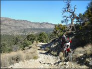
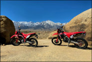 Alabama Hills
Status: Open
Type: Trail (BLM)
Location: Lone Pine, CA
Difficulty:

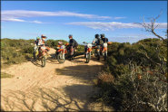
With unique landscape filled with colorful boulders and excellent views of Mount Whitney, it’s no wonder why Alabama Hills is one of the top film locations for major movie studios. More...
 Amago Sports Park
 Status: Open
Type: Track (Privately Owned / Commercial)
Location: Pauma Valley, CA
Difficulty:

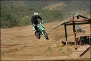
This motocross park has three tracks that range from a main, beginner/vet track and a peewee. More...
 Argyll MX Park
 Status: Open
Type: Track (Privately Owned / Commercial)
Location: Dixon, CA
Difficulty:
This motocross park has a groomed main track that consists of adobe clay and silt featuring 50 foot and 70 foot doubles. More...
 Baldy Mesa
 Status: Open
Type: Trail (National Forest)
Location: Phelan, CA
Difficulty:
This popular area recently reopened after a period of closure due to fire damage. More...
 Ballinger Canyon OHV Area
 Status: Open
Type: Trail (National Forest)
Location: Cuyama, CA
Difficulty:
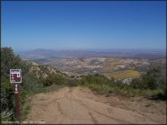
This popular off-road area has about 68 miles of marked and rated ATV trails on public land. More...
 Barker Meadow OHV Trail
 Status: Open
Type: Trail (National Forest)
Location: Tahoe City, CA
Difficulty:
This old logging road is about two miles long each way and is mostly hard packed with moderate elevation changes. More...
 Barona Oaks MX
 Status: Open
Type: Track (Privately Owned / Commercial)
Location: Ramona, CA
Difficulty:
This motocross park has been in business for over 35 years and offers a main and peewee track. More...
 Bee Canyon Truck Trail
 Status: Open
Type: Trail (National Forest)
Location: Hemet, CA
Difficulty:
This part of the San Bernardino National Forest features about 20 miles of easy to moderately challenging forest service roads that form several forks. More...
 Big Bear Lake
 Status: Open
Type: Trail (National Forest)
Location: Big Bear City, CA
Difficulty:
This high desert area offers about six miles of ATV trails and about 62 miles of surrounding 4x4 trails. More...
 Big Meadows
Status: Closed For Season
Type: Trail (National Forest)
Location: Miramonte, CA
Difficulty:
This part of the Sequoia National Forest offers miles of novice and moderately challenging trails and a small sand pit. More...
(Page 1 of 20)

Trail Hotline
Foresthill OHV
The Foresthill OHV Area open/closure status is determined based on soil moisture, therefore the status will change throughout the year (day to day) depending on weather conditions. For current updates check the hotline with a recorded message at (530) 367-2224 x228.
Details... Map...Permit Update
Nordhoff Ridge Road
Reservations for a permit are being accepted by email only. Send an email with your phone number in the email to steven.yamshon@usda.gov. Walk-ins or mail-ins are no longer accepted. The permit is free but is limited to four people per vehicle, no exceptions. For more information call (805) 448-4710.
Details... Map...
Respect Private Property and Local Residents
Humbug OHV Area
A local resident has reported that visitors sometimes use Georgia St, North St or Humbug Road within the city limits to access the Humbug OHV Area. This is not the correct access route. Please trailer in your machines and stage at the designated staging area. Be considerate of home owners and stay off city streets and obey all traffic laws. Vehicles not equipped for highway use are prohibited on city streets and violators will be ticketed.
Details... Map...
Track Status
Quail Canyon Motocross Track
Quail Canyon MX is currently closed until further notice due to damage caused by the Post Fire. For more information call (661) 248-7007 or (661) 248-7013.
Details... Map...
2025 Mammoth Bar Motocross Track Schedule Changes
Mammoth Bar OHV
As of October 15, 2024 through April 15, 2025 the motocross track ride days will be limited to Wednesday, Friday and Saturday. April 16, 2025 through October 14, 2025 will be limited to Friday and Saturday. This change has become necessary due to the nature of the soil and personnel/equipment commitment required for dust mitigation and grooming. As conditions, personnel and equipment change, this modification to track ride days will be reevaluated. The trails, 90cc track and trials area will ...
Details... Map...(Page 1 of 20)