| Home > California |
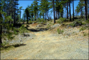 Elk Camp Ridge Trail
Status: Open
Type: Trail (National Forest)
Location: Gasquet, CA
Difficulty:

This very challenging single track trail was once an old pack train/mining road used during the late 1800's that connected the outskirts of Crescent City to the gold mines of southern Oregon. More...
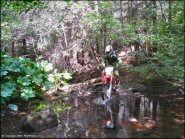 Elkins Flat OHV Routes
Status: Temporarily Closed (due to damage caused by the 2021 Caldor Fire)
Type: Trail (National Forest)
Location: Pioneer, CA
Difficulty:

This part of the Eldorado National Forest offers a network of mostly motorcycle-only woods trails of a wide range of difficulty. More...
 Eshom Point
Status: Open
Type: Trail (National Forest)
Location: Miramonte, CA
Difficulty:

This secluded area offers around 25 miles of old forest service roads that form long and easy loops. More...
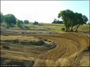 E-Street MX
Status: Open
Type: Track (Privately Owned / Commercial)
Location: Marysville, CA
Difficulty:

Once known to locals as Shad Pad, this motocross park offers two well-established tracks that consists of a main track and a separate beginners track. More...
 Evans Flat
Status: Open
Type: Trail (National Forest)
Location: Bakersfield, CA
Difficulty:

This part of the Sequoia National Forest offers miles of designated motorized trails for all vehicle types. More...
 Explore! Sierra
Status: Temporarily Closed (until further notice)
Type: Trail (National Forest, Private)
Location: Sierra Valley, CA
Difficulty:

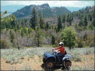
This 1,500 acre family ranch in Sierra Valley, California offers guided tours of about 27 miles of ranch trails with mountain forest scenery. More...
 Figueroa Mountain OHV Area
Status: Open
Type: Trail (National Forest)
Location: Los Olivos, CA
Difficulty:

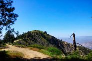
This part of the Los Padres National Forest has a few trails that are open to motorized use. More...
 Fingerlake MX
Status: Open
Type: Track (Privately Owned / Commercial)
Location: Red Bluff, CA
Difficulty:

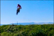
This motocross park offers a 1.2 miles natural terrain track that consists of sand, clay and sawdust, one mile quad track, 85cc peewee track, go-kart track and freestyle ramps. More...
 Foresthill OHV
Status: Variable Schedule (Depends on daily conditions. Call (530) 367-2224 x 228 for recorded message.)
Type: Trail (National Forest)
Location: Foresthill, CA
Difficulty:

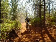
This off-road area offers plenty of shade, multiple staging areas, narrow winding trails and a nearby lake. More...
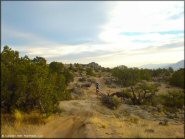 Fort Sage OHV Area
Status: Open
Type: Trail (BLM)
Location: Doyle, CA
Difficulty:

This is an out-of-the-way off-road area that is not well known to the general public, but it has marked trails spanning 28,598 acres, with newer facilities and plenty of privacy. More...


